2016-03-10
Tunnels and underground constructions
- Client: SOCIETE DU GRAND PARIS
- Project Management:GROUPEMENT SETEC/INGEROP
- Assignment: Concept studies in phases AVP and PRO
- Total cost of works: €868k (firm order)
- Completion date: 2013-2018
PROJECT DESCRIPTION AND CHARACTERISTICS
The study carried out by GEOS Ingénieurs Conseils constitutes a part of the project of construction of line 15 of the metro “Grand Paris Express”.
– Technical characteristics :
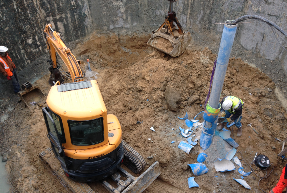
- The tunnel trajectory includes a tunnel Øi = 8.8 m of 4,000 m, dug with a cut-and-cover tunneling method, including three passages under the Seine,
- The works are a part of the geological context of the Senonian chalk,
- Construction of the entrance shaft of the cut-and-cover tunnel, Pont de Sèvres and Issy RER stations as well as the ancillary works.
ASSIGNMENT
As part of its participation, GEOS acts as a subcontractor of INGEROP.
GEOS participates in the project management of the civil engineering of the western section of lot 3 between Pont de Sèvres and Fort d’Issy / Vanves / Clamart.
GEOS conducted the Pre-Project and Project Studies.
These studies addressed, in particular, the following:
- Geotechnical design of stations
- Geotechnical design of the tunnel
- Interaction with existing structures.
2016-03-10
Geotechnics
- Client: AUTOROUTES DU SUD DE FRANCE
- General Contractor: INGEROP CONSEIL ET INGENIERIE
- Assignment: Geotechnical project management
- Total cost of work: AVP / PRO: €552k; VISA / DET: €434k
- Completion date: 2006-2016
PROJECT DESCRIPTION AND CHARACTERISTICS
The study carried out by GEOS Ingénieurs Conseils enters into the project of moving the A9 highway to Montpellier.
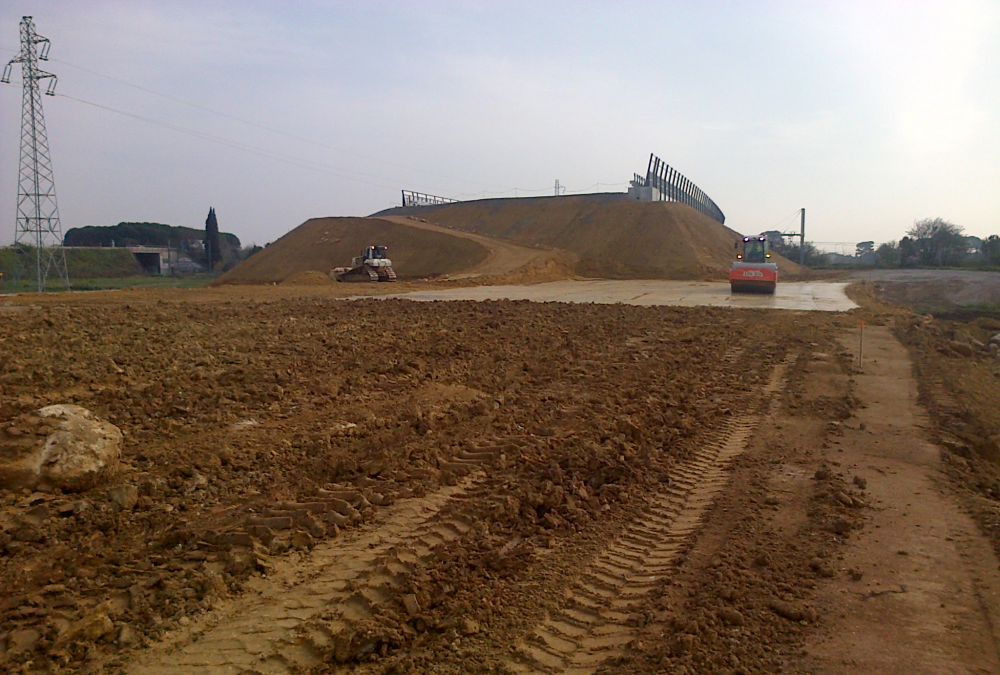
This 23-kilometer-long route consists half in widening the existing highway and half in building the new line.
In terms of earthworks, the route is deficient: 3.1Mm³ of embankments for 1.2Mm³ of cuttings excavated soil.
The new route crosses, in its central part, a vast plain of alluvial spreads (Lez-Lironde, Lantissargues…) and goes along the TGV line CNM under construction in a sector of compressible land, with a great lateral variability.
The backfills, 6- to 12-meter-high, were set up in advance to minimize their interaction with the CNM project. Vertical drains have been implemented under the most sensitive technical backfills.
ASSIGNMENT
GEOS, in collaboration with INGEROP’s engineering teams, the project’s Prime Contractor, carried out the geotechnical design studies (dossier: Highway Pre-project Phase) and carried out the geotechnical monitoring of the works (VISA, DET) .
This is defined in the NFP 94-500 standard for the G1-PGC / G2-AVP / G2-PRO / G2-DCE / ACT and G4 missions. These studies particularly addressed the following points:
- Definition of the geological, geotechnical and hydrogeological context of the project,
- Drafting of geotechnical parts of APA TCFH,
- AVP and PRO: Studies of earthworks (stability, slopes, settlements) and engineering structures,
- Definition of the complementary measurements (mask in cuttings, vertical drainage and preloading of the technical blocks),
- Definition of auscultations to be implemented,
- ACT: Technical assistance to write the tendering package and to examine the tenders,
- Approval of geotechnical implementation studies, approval forms and execution procedures,
- DET: Geotechnical supervision of the engineering structures.
2016-03-10
Geotechnics
- Client: ERE – EIFFAGE RAIL EXPRESS
- General Contractor: CLERE – CONCEPTION LIGNE EIFFAGE RAIL EXPRESS
- Assignment: Mission G2: Study of earthworks + foundations OA (design); Mission G4
- Total cost of work: €1,538k
- Completion date: 2011-2015
PROJECT DESCRIPTION AND CHARACTERISTICS
The high-speed line (LGV) Bretagne – Pays de la Loire is an extension of the LGV Atlantique Paris – Le Mans. It crosses the regions Brittany and Pays de la Loire and the departments of Sarthe, Mayenne and Ille et Vilaine. The total length of the route is 182 km plus 32 km of connection to the existing network. As part of its participation, GEOS worked on the 30km section B from Laval to Vitré.
ASSIGNMENT
GEOS conducted G2-AVP & PRO studies in the design phase. The studies include:
- definition, monitoring and control of geotechnical investigations;
- earthworks (stability of earthworks, reuse / recovery of materials, design specifications, geotechnical models);
- engineering structures (type of foundation, design specifications, etc.);
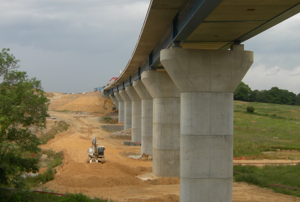
- the Vicoin estacade (an engineering structure consisting of nine spans with a total length of 260m).
The design mission was complemented by a supervision of geotechnical mission G4, including supervision of studies (VISA) and supervision of execution follow-up (DET).
2016-03-08
Tunnels and underground constructions
- Client: ANDRA
- Assignment: Draft studies, AMO of APS and APD phases,
- Completion date: 2012-2017
PROJECT DESCRIPTION AND CHARACTERISTICS
The study carried out by GEOS Ingénieurs Conseils constitutes a part of the project of underground storage of radioactive waste.
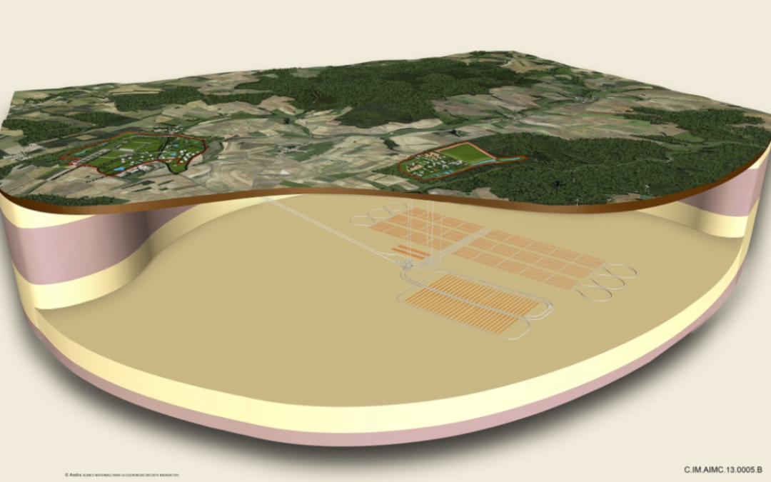
The technical characteristics of the project are: realization of two 4km declines, 4,550m wells and 200km galleries and underground storage cells at 500m depth in the Callovo-Oxfordian argillites.
The minimum operating period is 100 years.
ASSIGNMENT
GEOS carries out the following missions:
- Project management system: draft studies of the civil engineering of “underground works”;
- Assistance to the Client for the APS and APD phases.
2016-03-01
Geotechnics
- Client: RFF
- General Contractor: INGEROP
- Assignment: Assistance to the Project Manager
- Total cost of work: €12k
- Completion date: 2010 – 2011 studies 2013 – 2014 works
PROJECT DESCRIPTION AND CHARACTERISTICS
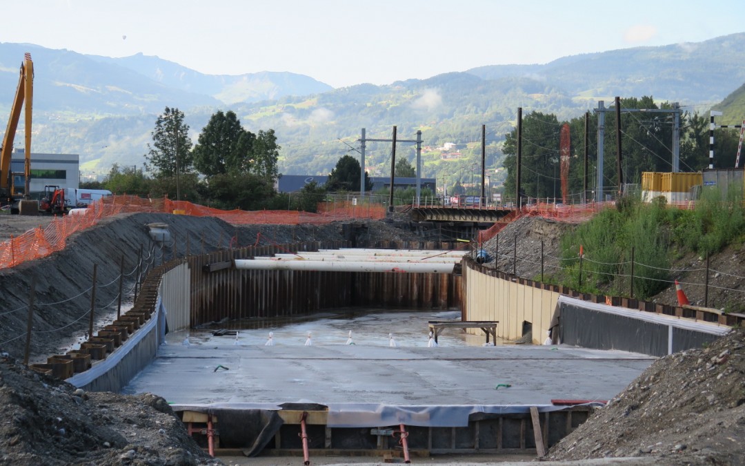
the railway crossing no.46 (PN 46) at the northern exit of the town of Sallanches, at the intersection of secondary road RD1205 (ex RN 205) and the railway line that connects La Roche sur Foron to Saint-Gervais les Bains. It is one of the 400 concerning PNs, identified by the Ministry of Infrastructure, RFF and SNCF, at the national level. In the chosen solution, the RD 1205 is slightly deflected and passes under the railway by a hopper and a lower passing way and joins the South roundabout. The structure is 225m long and about 15m wide. Because the groundwater level is located at a shallow depth and the permeability of the ground is high (gravelly alluvial deposits in Arve), the structure requires the use of a temporary sheet pilling support combined with a hydraulic plug at the bottom of the excavation. The final structure is a concrete open trench with a rail bridge in the middle.
ASSIGNMENT
GEOS conducted a G5 mission of expertise and geotechnical assistance within the meaning of the standard NF P 94-500.
These studies particularly addressed the following points:
- Definition of complementary geotechnical and hydrogeological investigation programs;
- Assistance to the project management for the piloting of the G2 mission, Project Phase carried out by an external geotechnical BE.

