Dams and hydraulic Engineering (Flooding management)
- Client: Japan International Cooperation Agency (JICA) and Ministry of Agriculture and Water Resources (MARH) of Tunisia
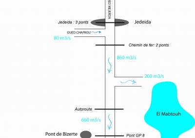
- Assignment: Across the watershed: Hydrological and hydraulic studies; Optimization of the operation of flood control dams in catchment area / In zone D2 (lower valley of the Mejerda): Diagnosis, Study and Preliminary design: Design, dimensioning of flood protection structures; Design, dimensioning of the El Mabtouh flooding basin
- Total cost of the assignment: 400 kCHF
- Completion date: 2013-2014
PROJECT DESCRIPTION AND CHARACTERISTICS
A “Master Plan for the Regulation of Flooding in the Medjerda River Basin” was developed within the framework of the Tunisian-Japanese Cooperation between 2006 and 2009, following the flood of 2003 which caused major damage. This master plan identified both structural and non-structural measures to prevent devastating flooding and to protect the population.
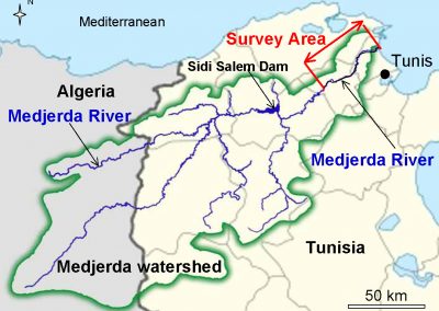
In order to implement the measures, the plan proposed, on the basis of protective measures and the level of development as well as the characteristics of the floods, a subdivision of the watershed of the Oued Medjerda, which covers an area of approximately 16,000 Km² in Tunisia, in four zones, two zones upstream of the Sidi Salem dam and two downstream, including zone D2.
The objective of the Integrated Management and Flood Control Project in the Mejerda Basin is to limit the damage caused by floods in the lower Oued, where so far most damage occurred. Due to improvement of the wadi and of dams, and also through training of the local personnel responsible for the system and through preparation of local population for the floods, this risk reduction will contribute to the economic and industrial development of Tunisia.
Oued Mejerda, 312km long, is the only perennial river in the country. Its basin, which covers a total area of 23,700 km² (of which 1/3 is in Algeria), is located in northern regions where precipitation is relatively high. It is a particularly important source of water for Tunisia.
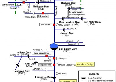
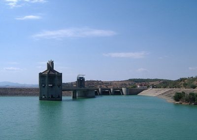
The country has focused its water resource management policy on retention. To this end, it has developed a vast complex of 27 reservoir dams in the northern part of the country, 13 of which are in the planning or construction phase. Until now, the management of dams has been orientated more towards retention of maximum volume of water than prevention of damages caused by the floods.
However, the dams play an essential role in protecting against the Mejerda floods. In order to optimize the drainage capacity of the whole device, it is necessary to know about a flood in advance to proceed with a preventive lowering of levels of reservoirs.
The volume of the floods is then contained by the dams that control the flows released to prevent downstream flooding while preserving as much water as possible.
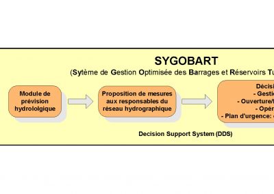
As a non-structural measure, a model concept for flood forecasting and management was proposed. The aim is to equip operators of the dams with a decision-making tool. The “MINERVE” system, developed in the context of flood management in the Rhône-Alpes basin with the optimization of hydroelectric production, is an example of functionality of such a tool.
The general principle of operation is shown in the diagram below. The system input data is meteorological forecasts, real-time rainfall and flow measurements, and rainfall and flows recorded in a database. On the basis of these elements, the hydrological forecast model simulates the hydrographic network response to a rain event. The results of modeling are the forecasts of the flows at critical points with possible scenarios. The proposed system allows decision makers to have an overview of evolution of flows in the network and to take appropriate measures accordingly.
ASSIGNMENT
GEOS’s missions consisted of several studies on flood control related in particular in the following subjects:
- Implementation of a hydrological model and management of MIKE BASIN watershed for the Mejerda catchment.
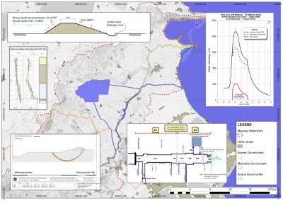
- Hydraulic modeling MIKE FLOOD on a 60 km section, in zone D2 according to the master plan.
- Optimization of the functioning of existing and future dams (horizon 2030) for flooding. Establishment of the basics for flood forecasting model at the watershed scale.
- Design of hydraulic structures (zone D2): dykes, 50 000 m³ flood-clearing basin, meandering resurfacing.


